
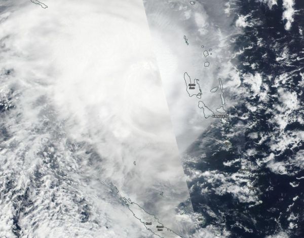
Tropical Cyclone Oma continued to stay just west of Vanuatu in the Southern Pacific Ocean as NASA-NOAA’s Suomi NPP satellite passed overhead and captured an image of the tropical storm.
Tropical Cyclone Oma continued to stay just west of Vanuatu in the Southern Pacific Ocean as NASA-NOAA’s Suomi NPP satellite passed overhead and captured an image of the tropical storm.
Tropical Cyclone Warning Number 26 was issued by the Vanuatu Meteorology and Geo-Hazards Department (VMGD), Port Vila at 3:05 a.m. VUT (local time) Saturday, February 16, 2019 (11 a.m. EDT, Feb. 15) for the Torba, Sanma and Malampa Provinces. The VMGD noted that: “Heavy rainfalls and flash flooding over low lying areas and areas close to the river banks, including coastal flooding will continue to affect Torba, Sanma and Malampa provinces tonight. Seas will remain very rough to phenomenal with heavy and phenomenal swells over the affected areas.”
Read more at NASA/Goddard Space Flight Center
Image: NASA-NOAA's Suomi NPP satellite passed over the Southern Pacific Ocean and captured a visible image of Tropical Cyclone Oma on Feb. 15 when it was passing west of Vanuatu. (Credit: NASA Worldview, Earth Observing System Data and Information System (EOSDIS))


