
Tropical Cyclone Haleh continues to weaken while being battered by outside winds.
Tropical Cyclone Haleh continues to weaken while being battered by outside winds. NASA-NOAA’s Suomi NPP satellite passed over the Southern Indian Ocean and captured an image the elongated storm.
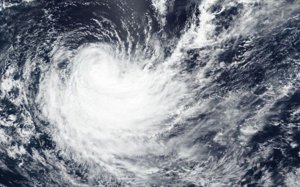
Wind shear and cooler waters continue to weaken Haleh is it moves on a southerly course. The storm has fallen below the hurricane threshold and is now a tropical storm. On March 7, the Visible Infrared Imaging Radiometer Suite (VIIRS) instrument aboard the Suomi NPP satellite showed Haleh appeared elongated from the outside winds.
In general, wind shear is a measure of how the speed and direction of winds change with altitude. In order to understand how it affects a tropical cyclone or hurricane, think of a tropical cyclone as a vertical rotating cylinder. The different levels of rotating winds in the center of tropical cyclones need to be stacked on top each other for the storm to strengthen. If there are outside winds pushing against the cylinder near the top, it affects the balance of the entire cylinder and that’s what happens when vertical wind shear pushes against a storm. It pushes the center and weakens (or wobbles) the rotation of the entire cylinder (storm) and stretches the storm out.
Read more at NASA/Goddard Space Flight Center
Image: On March 7, 2019, the VIIRS instrument aboard NASA-NOAA's Suomi NPP satellite captured a visible image of Haleh in the Southern Indian Ocean. (Credit: NASA Worldview, Earth Observing System Data and Information System (EOSDIS))


