
Visible imagery from NASA’s Terra satellite showed Tropical Cyclone Veronica skirting the Pilbara coast of Western Australia.
Visible imagery from NASA’s Terra satellite showed Tropical Cyclone Veronica skirting the Pilbara coast of Western Australia.
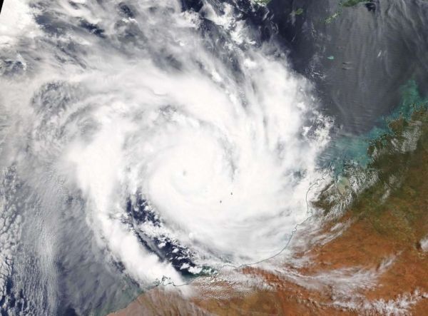
On March 21 the Moderate Resolution Imaging Spectroradiometer or MODIS instrument aboard NASA’s Terra satellite provided a visible image of Veronica. Veronica had a 10 nautical mile wide pinhole eye surrounded by powerful thunderstorms. Bands of thunderstorms spiraled into the center of circulation from the northwest and east. Veronica’s southeastern quadrant was spreading clouds along the Pilbara coastline of northern Western Australia.
The Australian Bureau of Meteorology or ABM updated warnings and watches on March 21, 2019. The Warning zone stretches from Pardoo to Mardie including Port Hedland, Karratha and Barrow Island. The Watch zone stretches from Pardoo to Wallal Downs, Mardie to Onslow and extending to the inland Pilbara to include Pannawonica, Tom Price and Marble Bar.
Read more at NASA / Goddard Space Flight Center
Image: On March 21, 2019, the MODIS instrument aboard NASA’s Terra satellite provided a visible image of Tropical Cyclone Veronica in the Southern Indian Ocean and affecting the Pilbara coast of Western Australia. CREDIT: NASA Worldview, Earth Observing System Data and Information System (EOSDIS)


