
NASA’s Aqua satellite saw Tropical Cyclone Lorna was being torn apart by strong northwesterly wind shear in the Southern Indian Ocean.
NASA’s Aqua satellite saw Tropical Cyclone Lorna was being torn apart by strong northwesterly wind shear in the Southern Indian Ocean.
In general, wind shear is a measure of how the speed and direction of winds change with altitude. Tropical cyclones are like rotating cylinders of winds. Each level needs to be stacked on top each other vertically in order for the storm to maintain strength or intensify. Wind shear occurs when winds at different levels of the atmosphere push against the rotating cylinder of winds, weakening the rotation by pushing it apart at different levels.
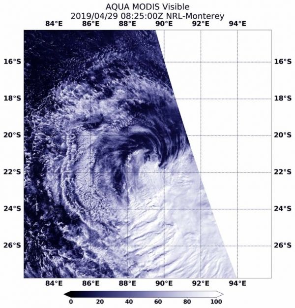
On April 29 at 4:29 a.m. EDT (0829 UTC), the Moderate Resolution Imaging Spectroradiometer or MODIS instrument aboard NASA’s Aqua satellite provided a visible image of Lorna. Northwesterly winds were pushing the bulk of Lorna’s clouds far southeast of its center.
Read more at NASA / Goddard Space Flight Center
Image: On April 29 at 4:29 a.m. EDT (0829 UTC), the MODIS instrument aboard NASA’s Aqua satellite provided a visible image of Tropical Cyclone Lorna in the Southern Indian Ocean. CREDIT: NASA/NRL


