
NASA’s Aqua satellite used infrared light to analyze the strength of storms in Tropical Cyclone Lili as it moved through the Southern Indian Ocean.
NASA’s Aqua satellite used infrared light to analyze the strength of storms in Tropical Cyclone Lili as it moved through the Southern Indian Ocean. Infrared data provides temperature information, and the strongest thunderstorms that reach high into the atmosphere have the coldest cloud top temperatures.
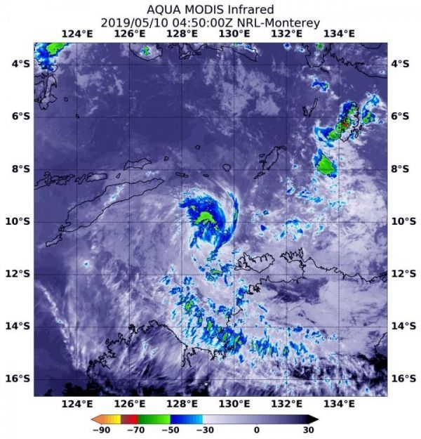
At 12:50 a.m. EDT (0450 UTC) on May 10, the Moderate Imaging Spectroradiometer or MODIS instrument that flies aboard NASA’s Aqua satellite gathered infrared data on Lili. Strongest thunderstorms were north of the center where MODIS found cloud top temperatures as cold as minus 50 degrees Fahrenheit (minus 45.5 Celsius).
Read more at NASA/Goddard Space Flight Center
Image: At 12:50 a.m. EDT (0450 UTC) on May 10, 2019, the MODIS instrument that flies aboard NASA's Aqua satellite gathered infrared data on Tropical Cyclone Lili. Strongest thunderstorms north of the center where cloud top temperatures were as cold as minus 50 degrees Fahrenheit (minus 45.5 Celsius). (Credit: NASA/NRL)


