
When people hear about hurricanes most immediately think of high winds.
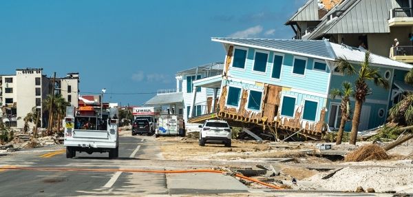
When people hear about hurricanes most immediately think of high winds. But it’s the water that’s responsible for nearly 90% of fatalities – and half of those are due to storm surge. Do you know if you’re at risk?
Thanks to improved computer modeling, several years of experimentation, and social science research, NOAA’s National Hurricane Center has an interactive web tool, the National Storm Surge Hazard Maps to help you find out. The first version was issued in 2014 and covered the U.S coastline from Texas to Maine. Puerto Rico was added in 2017. This year the system has expanded to include the Hawaiian Islands, U.S. Virgin Islands, and Hispaniola.
These storm surge hazard mapsoffsite link enable people living in hurricane-prone coastal areas to evaluate their risk of coastal flooding due to storm surge. And don’t forget, storm surge is not just a beachfront problem. The hazard extends many miles inland from the immediate coastline in some areas. Understanding this risk gives you the time to take action when emergency managers tell you to evacuate.
Continue reading at NOAA.
Image via NOAA.


