
Extreme erosion of Arctic coastlines in a changing climate – up to a metre a day – has been revealed with drone surveys.
Extreme erosion of Arctic coastlines in a changing climate – up to a metre a day – has been revealed with drone surveys.
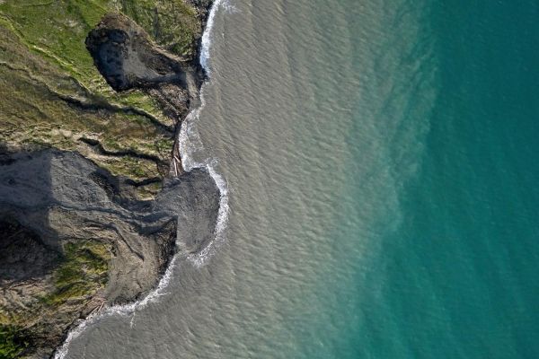
Storms in the Canadian Arctic are washing away increasing amounts of coastal permafrost – frozen ground – which is exposed when sea ice melts during the summer.
The results highlight the ongoing change in the region, as a warming climate leads to longer summer seasons.
Sea ice melts earlier and reforms later in the year than before, exposing the coastline and presenting more opportunities for storms to cause damage.
Arial cameras
An international team of researchers led by the University of Edinburgh flew drone-mounted cameras over a section of permafrost coastline on Herschel Island, also known as Qikiqtaruk, off the Yukon coast in the Canadian Arctic.
Read more at University of Edinburgh
Image: Scientists led by the University of Edinburgh used drone-mounted cameras to study erosion of permafrost coastline on Qikiqtaruk - Herschel Island, Yukon Territory, in the Canadian Arctic. (Credit: Jeffrey Kerby)


