
Visible imagery from NASA’s Aqua satellite showed Tropical Cyclone Vayu has a compact central dense overcast cloud cover.
Visible imagery from NASA’s Aqua satellite showed Tropical Cyclone Vayu has a compact central dense overcast cloud cover. Vayu’s center was off-shore from India’s Gujarart coast.
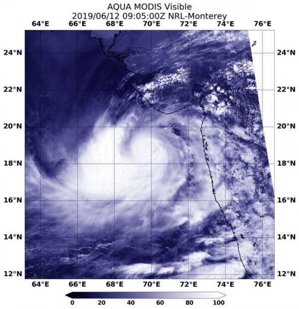
On June 12 at 4:05 a.m. EDT (0905 UTC), the Moderate Resolution Imaging Spectroradiometer or MODIS instrument aboard NASA’s Aqua satellite provided a visible image of Vayu. Vayu’s center was off the western coast of India, in the Arabian Sea. Although hurricane-strength, the MODIS image showed a cloud-filled center of circulation and compact central dense overcast feature, approximately 90 to 100 nautical miles in diameter. The MODIS visible image also showed a thick band of thunderstorms wrapped into the low-level center from the western and southern quadrants. Meanwhile, satellite microwave imagery revealed a small eye beneath that overcast.
Read more at NASA/Goddard Space Flight Center
Image: On June 12 at 4:05 a.m. EDT (0905 UTC), the MODIS instrument aboard NASA's Aqua satellite provided a visible image of Tropical Cyclone Vayu and showed a compact center of circulation. (Credit: NASA/NRL)


