
At 11 a.m. EDT (5 a.m. HST/1500 UTC), on August 1, NOAA’s National Hurricane Center (NHC) said the center of Tropical Storm Flossie was located near latitude 15.1 degrees north and longitude 131.6 degrees west.
At 11 a.m. EDT (5 a.m. HST/1500 UTC), on August 1, NOAA’s National Hurricane Center (NHC) said the center of Tropical Storm Flossie was located near latitude 15.1 degrees north and longitude 131.6 degrees west. That’s about 1,580 miles (2,540 km) east of Hilo, Hawaii. Flossie is moving toward the west-northwest near 16 mph (26 kph), and this general motion is expected to continue through early Sunday. Maximum sustained winds are near 65 mph (100 kph) with higher gusts. Little change in strength is anticipated for the next couple of days. The estimated minimum central pressure is 996 millibars.
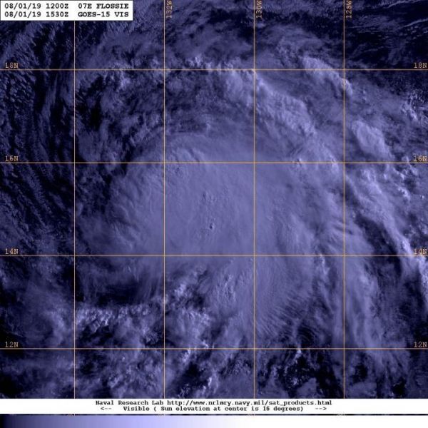
NOAA’s GOES-West satellite captured a visible image of Tropical Storm Flossie on August 1 at 11:30 a.m. EDT (1530 UTC) and the storm’s structure had not really changed overnight. However, recent SSMI microwave data indicate that the center of the tropical storm is displaced to the northwest of all of its strongest storms.
NOAA manages the GOES series of satellites and the NASA builds and launches the satellites for NOAA. The NASA/NOAA GOES Project is located at NASA’s Goddard Space Flight Center in Greenbelt, Maryland.
Read more at: NASA/Goddard Space Flight Center
NOAA's GOES-West satellite captured a visible image of Tropical Storm Flossie on August 1 at 11:30 a.m. EDT (1530 UTC) in the Eastern Pacific Ocean. (Photo Credit: NOAA/NRL)


