
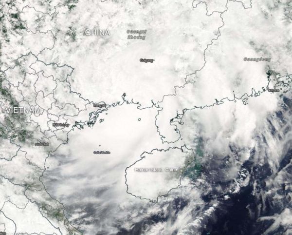
Visible satellite imagery from NASA’s Aqua satellite showed the clouds from Tropical Storm Wipha blanketing the Gulf of Tonkin.
Visible satellite imagery from NASA’s Aqua satellite showed the clouds from Tropical Storm Wipha blanketing the Gulf of Tonkin.
The Gulf of Tonkin is a body of water located in the northern part of the South China Sea. It is located off the coast of northern Vietnam and southern China.
On Aug. 2, 2019, a Tropical Storm Warning was in effect for coastal areas in northeastern Vietnam. The Vietnam National Center for Hydro-Meteorological Forecasting (NCHF) expects Wipha to track along the southern China coast and move into Vietnam tracking to the southwest. NCHF expects Wipha’s center to pass just south of Hanoi.
At 11 a.m. EDT (1500 UTC) on Aug. 2, Wipha had maximum sustained winds near 35 knots (40 mph/64 kph). It was centered near 21.6 degrees north latitude and 108.5 degrees east longitude, about 150 nautical miles east-northeast of Hanoi, Vietnam. Wipha was moving to the west.
Read more at NASA / Goddard Space Flight Center
Image: On Aug. 2, 2019, the MODIS instrument aboard Aqua captured a visible image of Tropical Storm Wipha in the Gulf of Tonkin, South China Sea, headed for landfall in northern Vietnam. Credit: NASA Worldview, Earth Observing System Data and Information System (EOSDIS)


