
Infrared imagery from NASA’s Aqua satellite shows that Tropical Storm Francisco had powerful thunderstorms with heavy rain capabilities around the center of circulation as it moves toward landfall in southern Japan.
Infrared imagery from NASA’s Aqua satellite shows that Tropical Storm Francisco had powerful thunderstorms with heavy rain capabilities around the center of circulation as it moves toward landfall in southern Japan.
On Aug. 5, 2019, the Japan Meteorological Agency has issued warnings for the Amami, Kyushu and Shikoku. Advisories are in effect for Chugoku, Kinki Ogasawara, Okinawa and Tokai.
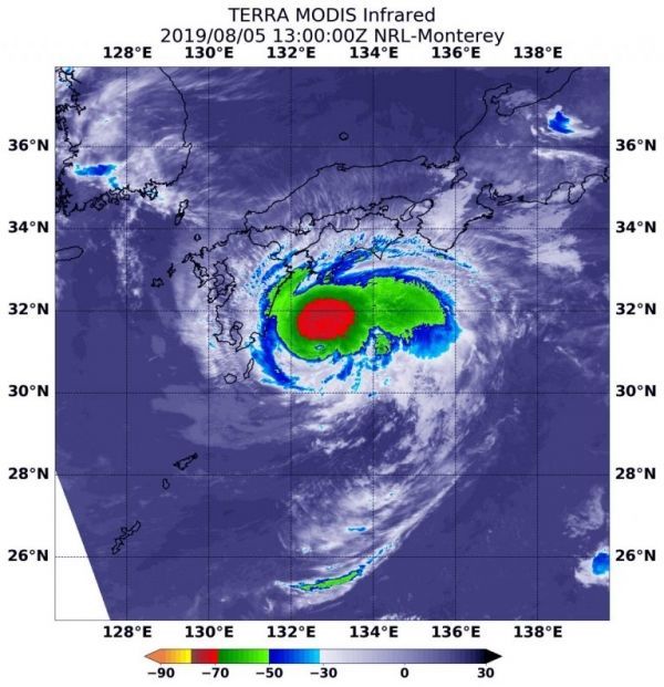
NASA’s Aqua satellite used infrared light to analyze the strength of storms in Tropical Storm Francisco and found strongest storms circling the center. Infrared data provides temperature information, and the strongest thunderstorms that reach high into the atmosphere have the coldest cloud top temperatures.
Read more at NASA / Goddard Space Flight Center
Image: On Aug. 5 at 9 a.m. EDT (1300 UTC) the MODIS instrument that flies aboard NASA’s Aqua satellite showed strongest storms (red) in Tropical Storm Francisco circled the center. There, cloud top temperatures were as cold as minus 70 degrees Fahrenheit (minus 56.6 Celsius). Credit: NASA/NRL


