
Former Hurricane Flossie was nothing more than a remnant low pressure area early on Tuesday, August 6.
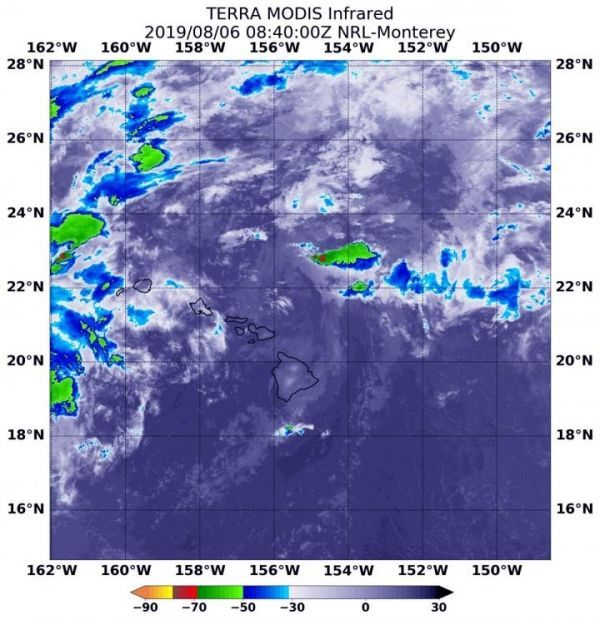
Former Hurricane Flossie was nothing more than a remnant low pressure area early on Tuesday, August 6. Infrared imagery from NASA’s Aqua satellite found just a few scattered areas of cold clouds in thunderstorms in the remnants, now west of the Hawaiian Islands.
NASA’s Aqua satellite uses infrared light to analyze the strength of storms by providing temperature information about the system’s clouds. The strongest thunderstorms that reach high into the atmosphere have the coldest cloud top temperatures.
On August 6 at 4:40 a.m. EDT (0840 UTC), the Moderate Imaging Spectroradiometer or MODIS instrument that flies aboard NASA’s Aqua satellite gathered infrared data on Flossie.
MODIS found just a few scattered areas of cold clouds in thunderstorms in the remnants, northeast of the Hawaiian Islands. Those thunderstorms had cloud top temperatures as cold as minus 50 degrees Fahrenheit (minus 45.5 Celsius).
Read more at NASA/Goddard Space Flight Center
Image: On August 6, 2019 at 4:40 a.m. EDT (0840 UTC), the MODIS instrument that flies aboard NASA's Aqua satellite showed strongest thunderstorms in the remnants of Flossie were fragmented northeast of the Hawaiian Islands. There cloud top temperatures were as cold as minus 50 degrees Fahrenheit (minus 45.5 Celsius). (Credit: NASA/NRL)


