
Carbon monoxide plays a role in both air pollution and climate change.
New data from NASA's Atmospheric Infrared Sounder (AIRS) instrument, aboard the Aqua satellite, shows the movement high in the atmosphere of carbon monoxide associated with fires in the Amazon region of Brazil.
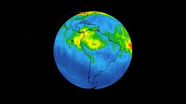
This time series maps carbon monoxide at an altitude of 18,000 feet (5,500 meters) from Aug. 8-22, 2019. As the series progresses, the carbon monoxide plume grows in the northwest Amazon region then drifts in a more concentrated plume toward the southeastern part of the country.
Each "day" in the series is made by averaging three days' worth of measurements, a technique used to eliminate data gaps. Green indicates concentrations of carbon monoxide at approximately 100 parts per billion by volume (ppbv); yellow, at about 120 ppbv; and dark red, at about 160 ppbv. Local values can be significantly higher.
Continue reading at NASA
Image via NASA


