
NASA-NOAA’s Suomi NPP satellite passed over the Eastern Pacific Ocean in the early hours of Sept. 12 and grabbed a nighttime look at Tropical Storm Kiko.
NASA-NOAA’s Suomi NPP satellite passed over the Eastern Pacific Ocean in the early hours of Sept. 12 and grabbed a nighttime look at Tropical Storm Kiko.
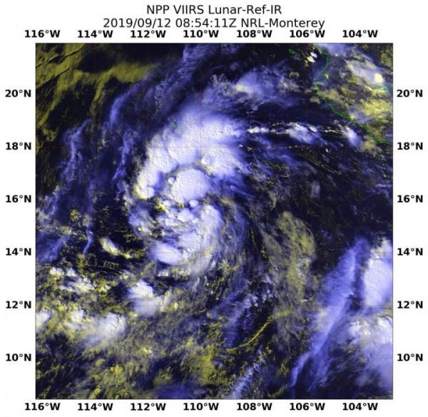
Kiko developed on Sept. 11 as Tropical Depression 13E and strengthened into a tropical storm by 5 p.m. EDT. Once it attained tropical storm status, it was named Kiko.
On Sept. 12 at 4:54 a.m. EDT (0854 UTC), the Visible Infrared Imaging Radiometer Suite (VIIRS) instrument aboard NASA-NOAA’s Suomi NPP provided an infrared image of the strengthening storm. At the time of the overpass the National Hurricane Center (NHC) noted, “There’s a small patch of convection (rising air that formed thunderstorms) near the estimated center, with another larger cluster much farther south. For the most part, however, the circulation consists of a broken low- and mid-level cloud deck with a few embedded showers.” The Suomi NPP image also showed a larger band of thunderstorms had developed north of center.
Read more at NASA/Goddard Space Flight Center
Image: NASA-NOAA's Suomi NPP satellite passed over Tropical Storm Kiko in the Eastern Pacific Ocean and the VIIRS instrument aboard captured this image of the storm on Sept. 12 at 4:54 a.m. EDT (0854 UTC). (Credit: NASA/NOAA/NRL)


