
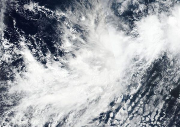
NASA-NOAA’s Suomi NPP satellite imagery revealed Tropical Storm Mario appeared to be losing its rounded shape in the Eastern Pacific Ocean.
NASA-NOAA’s Suomi NPP satellite imagery revealed Tropical Storm Mario appeared to be losing its rounded shape in the Eastern Pacific Ocean.
When tropical cyclones begin to lose their shape and appear less circular, it is generally an indication of a storm that is weakening. Circular storms can spin faster, just like a tire on a car. Once the tire loses its circular shape it can’t rotate as fast.
The Visible Infrared Imaging Radiometer Suite (VIIRS) instrument aboard Suomi NPP provided a visible image of Mario on Sept. 18 at 5:36 p.m. EDT (2136 UTC) that indicated wind shear was affecting the storm as it did not appear circular as a result of wind shear. NPP data is used by forecasters at NOAA’s National Hurricane Center to assess factors of the storm that include structure and strength.
NASA’s Aqua satellite also passed over Mario and provided cloud top temperature data. Aqua showed Mario contained some powerful thunderstorms stretching high into the troposphere with cloud top temperatures as cold as or colder than 220 Kelvin (minus 63 degrees Fahrenheit / minus 53 degrees Celsius). NASA research has shown that storms with cloud top temperatures that cold can produce heavy rainfall.
Read more at NASA / Goddard Space Flight Center
Image: NASA-NOAA’s Suomi NPP satellite passed over Tropical Storm Mario on Sept. 18 at 5:36 p.m. EDT (2136 UTC) and observed that the storm appeared somewhat elongated. Credit: NASA Worldview, Earth Observing System Data and Information System (EOSDIS)


