
As Tropical Storm Lorena was nearing landfall in northwestern Mexico, NASA-NOAA’s Suomi NPP satellite provided forecasters with an image of the storm. By Monday, Sept. 23, Lorena’s remnants were affecting the southern U.S. and bringing heavy rainfall to Arizona.
As Tropical Storm Lorena was nearing landfall in northwestern Mexico, NASA-NOAA’s Suomi NPP satellite provided forecasters with an image of the storm. By Monday, Sept. 23, Lorena’s remnants were affecting the southern U.S. and bringing heavy rainfall to Arizona.
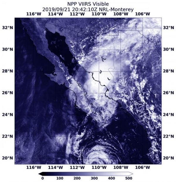
Visible imagery from NASA satellites help forecasters understand if a storm is organizing or weakening. The Visible Infrared Imaging Radiometer Suite (VIIRS) instrument aboard Suomi NPP provided a visible image of Lorena on Sept. 21 at 4:42 p.m. EDT (2042 UTC).
The shape of a tropical cyclone provides forecasters with an idea of its organization and strength, and NASA-NOAA’s Suomi NPP satellite provided a visible image of the storm to forecasters as its center was approaching landfall. The storm already appeared elongated from south to north after its northeastern side had begun moving over the high terrain of northwestern Mexico. Lorena made a slow track to the coast and made landfall about 12 hours later.
Read more at: NASA/Goddard Space Flight Center
NASA-NOAA's Suomi NPP satellite passed over Tropical Storm Lorena as it was approaching landfall in northwestern Mexico on Sept. 21 at 4:42 p.m. EDT (2042 UTC). (Photo Credit: NASA Worldview, Earth Observing System Data and Information System EOSDIS)


