
The extent of Arctic sea ice at the end of this summer was effectively tied with 2007 and 2016 for second lowest since modern record keeping began in the late 1970s. An analysis of satellite data by NASA and the National Snow and Ice Data Center (NSIDC) at the University of Colorado Boulder shows that the 2019 minimum extent, which was likely reached on Sept. 18, measured 1.60 million square miles (4.15 million square kilometers).
The extent of Arctic sea ice at the end of this summer was effectively tied with 2007 and 2016 for second lowest since modern record keeping began in the late 1970s. An analysis of satellite data by NASA and the National Snow and Ice Data Center (NSIDC) at the University of Colorado Boulder shows that the 2019 minimum extent, which was likely reached on Sept. 18, measured 1.60 million square miles (4.15 million square kilometers).
The Arctic sea ice cap is an expanse of frozen seawater floating on top of the Arctic Ocean and neighboring seas. Every year, it expands and thickens during the fall and winter and grows smaller and thinner during the spring and summer. But in the past decades, increasing temperatures have caused marked decreases in the Arctic sea ice extents in all seasons, with particularly rapid reductions in the minimum end-of-summer ice extent.
Changes in Arctic sea ice cover have wide-ranging impacts. The sea ice affects local ecosystems, regional and global weather patterns, and the circulation of the oceans.
Read more at: NASA/Goddard Space Flight Center
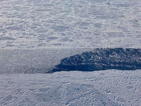
An opening in the sea ice cover north of Greenland is partially filled in by much smaller sea ice rubble and floes, as seen during an Operation IceBridge flight on Sept. 9, 2019. (Photo Credit: NASA/Linette Boisvert)


