
NASA’s Terra satellite captured an image of Tropical Storm Karen on Sept. 26 and found the strongest thunderstorms west of center.
NASA’s Terra satellite captured an image of Tropical Storm Karen on Sept. 26 and found the strongest thunderstorms west of center.
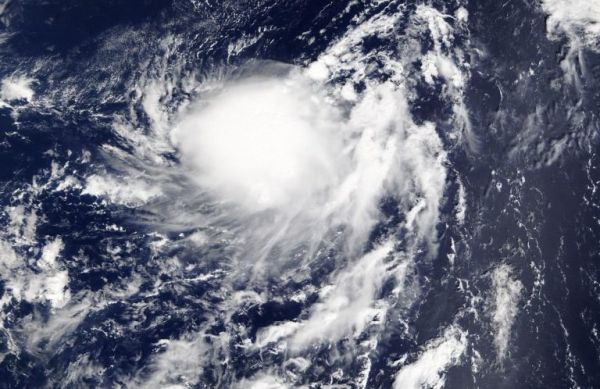
On Sept. 26 at 1:30 p.m. EDT on Sept. 26, the Moderate Imaging Spectroradiometer or MODIS instrument that flies aboard NASA’s Terra satellite provided a visible image of Karen. The image showed the Karen has been maintaining a cluster of developing thunderstorms and convection to the west of center. NOAA’s National Hurricane Center noted that visible satellite images, such as the one from NASA’s Terra satellite and wind data from NOAA buoy 40149 to the northeast, suggest that the low-level circulation is becoming elongated. When a storm becomes elongated, it’s a sign of weakening.
The shape of the storm is a clue to forecasters that a storm is either strengthening or weakening. If a storm takes on a more rounded shape it is getting more organized and strengthening. Conversely, if it becomes less rounded or elongated, like Karen, it is a sign the storm is weakening.
Read more at NASA / Goddard Space Flight Center
Image: On Sept. 26 at 1:30 p.m. EDT, the MODIS instrument that flies aboard NASA’s Terra satellite captured this visible image of Karen, that showed a cluster of storms west of center and the storm appeared somewhat elongated. Credit: NASA Worldview


