
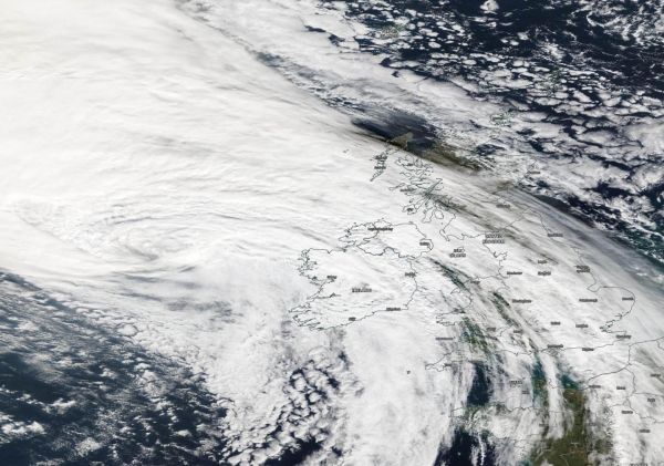
NASA’s Terra satellite passed over the eastern North Atlantic Ocean early on Oct. 3 and captured a visible image of Post-tropical Cyclone Lorenzo as it neared Ireland.
NASA’s Terra satellite passed over the eastern North Atlantic Ocean early on Oct. 3 and captured a visible image of Post-tropical Cyclone Lorenzo as it neared Ireland. Lorenzo’s eastern side is already affecting Ireland, and both Ireland and the United Kingdom have posted warnings today.
On Oct. 3, Lorenzo was still a powerful post-tropical storm. NASA satellite images indicated that frontal features had formed as indicated by its elongated appearance.
The Moderate Imaging Spectroradiometer or MODIS instrument that flies aboard NASA’s Terra satellite provided a visible image of Lorenzo. The MODIS image showed the cloud-filled center of circulation west of Ireland. Clouds and precipitation associated with the system had already spread over Ireland and parts of the United Kingdom.
Read more at: NASA/Goddard Space Flight Center
TOn Oct. 3, the MODIS instrument that flies aboard NASA's Terra provided a visible image of Post-Tropical Cyclone Lorenzo moving through the North Atlantic Ocean and just west of Ireland. (Photo Credit: NASA Worldview, Earth Observing System Data and Information System (EOSDIS).


