
Former Tropical Storm Nakri strengthened into a Typhoon in the South China Sea on Nov. 8.
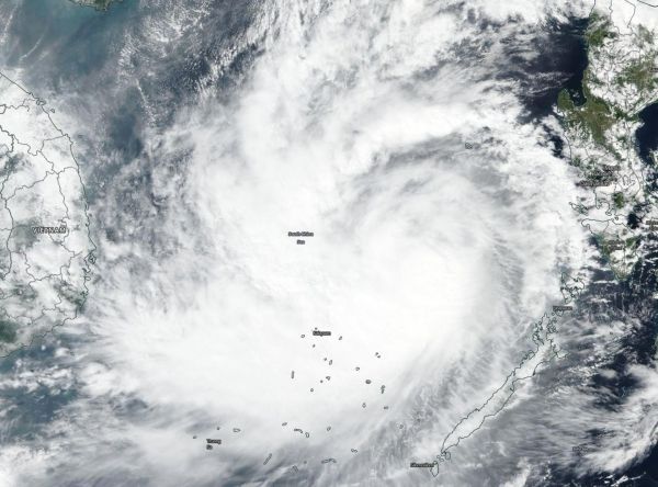
Former Tropical Storm Nakri strengthened into a Typhoon in the South China Sea on Nov. 8. NASA-NOAA’s Suomi NPP satellite passed over the region and found Nakri appeared more circular and more organized.
Visible imagery from the Visible Infrared Imaging Radiometer Suite (VIIRS) instrument aboard NASA-NOAA’s Suomi NPP satellite on Nov. 8 showed Nakri appeared more circular indicating it had intensified. The imagery also showed a large band on thunderstorms west of the center and wrapping into the low-level center. The center of the storm was still west of the main Philippine Islands, and north of Palawan. However, Kalayaan was still feeling the effects of the storm.
Kalayaan is a municipality on Pagasa Island in the province of Palawan, Philippines. Kalayaan is part of the Spratly Group of Islands, west of the largest island of Palawan. Nakri is known in the Philippines as Quiel.
Read more at NASA/Goddard Space Flight Center
Image: NASA-NOAA's Suomi NPP satellite passed over Typhoon Nakri on Nov. 8, 2019 and captured a visible image of the storm in the South China Sea. (Credit: NASA Worldview, Earth Observing System Data and Information System (EOSDIS))


