
The National Weather Service in Guam has posted warnings as Tropical Storm Kammuri lingers nearby.
The National Weather Service in Guam has posted warnings as Tropical Storm Kammuri lingers nearby. The NOAA-20 satellite provided forecasters with an image of the storm.
Tropical Depression 29W formed on Nov. 25, and when it strengthened into a tropical storm on Nov. 26 it was renamed Kammuri.
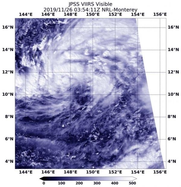
Visible imagery from NASA satellites help forecasters understand if a storm is organizing or weakening. The Visible Infrared Imaging Radiometer Suite (VIIRS) instrument aboard NOAA-20 provided a visible image of Kammuri on Nov. 26 at 0354 UTC (Nov. 25 at 10:54 p.m. EST) that shows it is consolidating and strengthening. The image showed bands of thunderstorms wrapping into its low level center.
On Nov. 26 (and Nov. 27 local time), a tropical storm warning remains in effect for Guam, Rota, Tinian and Saipan. Tropical storm conditions, including winds of 39 mph or more, are occurring and will persist through noon (local time on Nov. 27) today.
Read more at NASA/Goddard Space Flight Center
Image: NOAA-20 provided a visible image of Kammuri on Nov. 26 at 0354 UTC (Nov. 25 at 10:54 p.m. EST) that shows it is consolidating and strengthening. The image showed bands of thunderstorms wrapping into its low level center. (Credit: NOAA/NRL)


