
An undersea eruption at Lateiki Island in late October 2019 has brought new life to an older island in the Tonga chain.
At the same time that scientists were standing on and studying the five-year-old Hunga Tonga-Hunga Ha‘apai island, another island-building event was unfolding just 150 kilometers (90 miles) to the north-northeast in the Southwest Pacific Ocean. An undersea eruption at Lateiki Island in late October 2019 has brought new life to an older island in the Tonga chain.
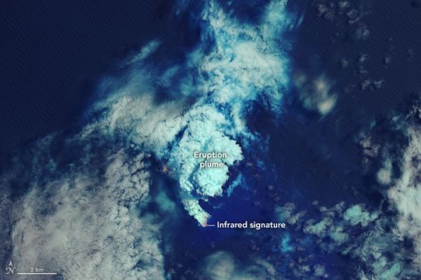
The birth of the island is visible in these images, acquired with the Operational Land Imager (OLI) on Landsat 8. The top image shows the eruption on its third day, October 16, 2019. The false-color image combines shortwave infrared, near infrared, and blue light (bands 7-5-2) to help distinguish the hot spots associated with the eruption (red). Scientists say the emissions were dominated by steam and volcanic gases.
When the plume cleared on November 1, satellites started getting clear views of the new land that had emerged. Landsat 8 acquired the second, natural-color image of Lateiki Island on November 17. Note that water around the island was still discolored from the eruption’s emissions. The new island measures about 400 meters (1300 feet) long and 100 meters (300 feet) wide.
Continue reading at NASA Earth Observatory
Image via NASA Earth Observatory


