
Tropical Storm Phanfone brought typhoon-force winds and heavy rains across sections of the Philippines on Christmas Eve and Christmas day.
Tropical Storm Phanfone brought typhoon-force winds and heavy rains across sections of the Philippines on Christmas Eve and Christmas day. Phanfone is known as Ursula in the Philippines. Now the storm has moved into the South China Sea and NASA’s Terra satellite captured an image of the tropical cyclone.
Phanfone’s maximum sustained winds peaked near 95 knots on Dec. 25 at 4 a.m. EST (0900 UTC) as it passed through the Philippine archipelago.
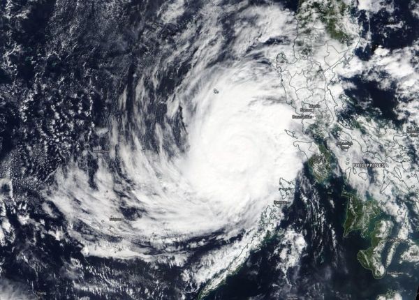
On Dec. 26, 2019, the Moderate Imaging Spectroradiometer or MODIS instrument that flies aboard NASA’s Terra satellite provided a visible image of Phanfone that showed the storm maintained its circular shape after crossing the Philippines. A rounded shape of a tropical cyclone indicates an organized storm. The MODIS image revealed bands of thunderstorms spiraled into the low-level center of circulation.
Read more at NASA / Goddard Space Flight Center
Image: On Dec. 26, 2019, the MODIS instrument that flies aboard NASA’s Terra satellite provided a visible image of Tropical Storm Phanfone re-strengthening in the South China Sea. Credit: NASA Worldview


