
Imagery from NASA-NOAA’s Suomi NPP satellite showed that a tropical low-pressure area has consolidated and organized in the Southern Pacific Ocean near Fiji.
Imagery from NASA-NOAA’s Suomi NPP satellite showed that a tropical low-pressure area has consolidated and organized in the Southern Pacific Ocean near Fiji.
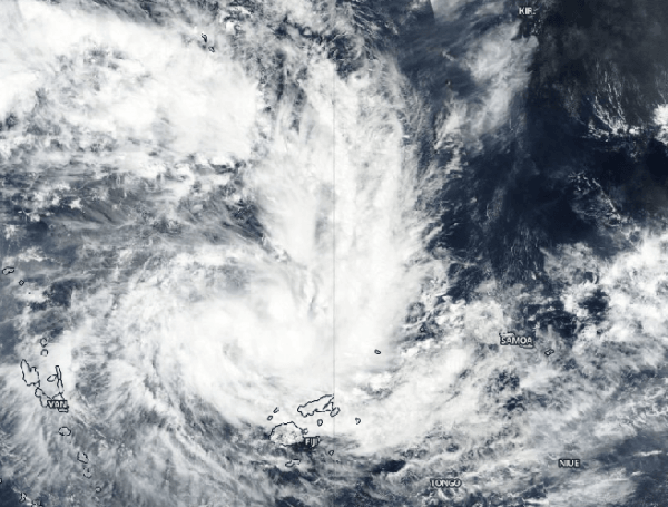
Tropical Storm Sarai has formed to the west of Fiji. Fiji is an archipelago, consisting of more than 300 islands in the South Pacific Ocean.
On Dec. 26 at 6:43 a.m. EST) Dec. 27 at 12:43 a.m. Fiji local time, the Fiji Meteorological Service has issued various warnings for Fiji and surrounding islands. A gale warning remains in force for Rotuma, Vanua Levu, Taveuni and nearby smaller islands, Yasawa and Mamanuca Group, Kadavu, Lomaiviti group, Viti Levu and nearby smaller islands. A strong wind warning remains in force for the rest of Fiji. A heavy rain warning remains in force for the Fiji group.
Read more at NASA / Goddard Space Flight Center
Image: NASA-NOAA’s Suomi NPP satellite passed over the Southern Pacific Ocean on Dec. 26 and found Tropical Storm Sarai had developed near Fiji. The image showed strong bands of thunderstorms from the western quadrant wrapping into the low-level center of circulation. Credit: NASA Worldview, Earth Observing System Data and Information System (EOSDIS)


