
Did you know that there are about 120 World War II era aircraft lying at the bottom of Lake Michigan?
The Navy used these aircraft to train and certify pilots to take off and land from aircraft carriers during World War II. U.S. Naval operations along Lake Michigan, one of the Great Lakes, began in 1923. Between 1923 and 1942, operations expanded as the Navy built hangars, airfields, and landing strips across the village of Glenview, Illinois. By 1942, the Navy had a robust presence on the shores of Lake Michigan. With the U.S. entrance into World War II, the Navy needed a location to train carrier pilots. The growing threat of enemy vessels and mines along the Pacific and Atlantic coastlines and an already strong Naval presence in the area made Lake Michigan the safest location for carrier training.
All existing carriers were needed on the front, so the Navy bought two sidewheel paddle steamers, the SS Seaandbee and SS Greater Buffalo, which they stripped and fitted with flight decks. Commissioned as the USS Wolverine and USS Sable these ships helped to train and qualify 17,820 pilots, including former President George H.W. Bush.
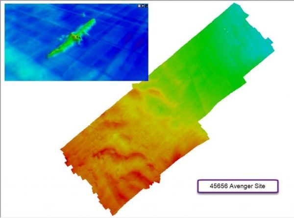
As this was a training site, crashes and emergency water landings did happen. The U.S. Coast Guard operated small yard patrol craft to rescue the pilots and drop a buoy over the downed plane to mark the location for recovery. Not all planes were recoverable and over 100 remained on the bottom of Lake Michigan.
These aircraft represent a significant part of U.S. history and offer a wealth of knowledge about the history of naval aviation. The cold, fresh waters of Lake Michigan provide ideal preservation conditions, and many of the aircraft are in such good condition that the paint scheme can still be used to help identify them. As part of an initiative to manage this collection of sunken aircraft, the Naval History and Heritage Command is leading an effort to find and preserve this piece of history.
Continue reading at NOAA Office of Coast Survey
Image via NOAA


