
The South Interior area of the state of Western Australia is under warnings for heavy rainfall and gusty winds as the remnants of Tropical Storm Blake move on a southeasterly path through the state.
The South Interior area of the state of Western Australia is under warnings for heavy rainfall and gusty winds as the remnants of Tropical Storm Blake move on a southeasterly path through the state. Imagery from NASA-NOAA’s Suomi NPP satellite provided an image of the storm’s clouds.
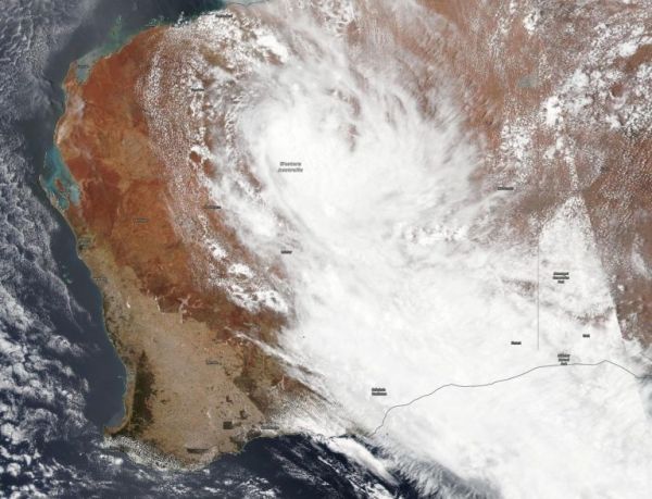
The Visible Infrared Imaging Radiometer Suite (VIIRS) instrument aboard Suomi NPP provided a visible image of Blake’s remnants that showed the storm stretched from the South Interior to Goldfields, Southeast Coastal and Eucla localities. The strongest storms appeared in the northwestern corner of the South Interior.
At 9 a.m. EST (10 p.m. AWST Australia local time) on Jan. 9, the Australian Bureau of Meteorology noted that: “Ex-Tropical Cyclone Blake was located approximately 155 miles (250 km) southeast of Newman, or 130 miles (210 km) northeast of Wiluna, moving slowly southeast through the South Interior.”
Read more at NASA / Goddard Space Flight Center
Image: NASA-NOAA’s Suomi NPP satellite passed over Western Australia and found the remnants of former Tropical Storm Blake now in the central part of the state. Credit: NASA Worldview, Earth Observing System Data and Information System (EOSDIS)


