
When NASA’s Aqua satellite passed over the Southern Pacific Ocean it gathered water vapor data that provided information about the intensity of Tropical Cyclone Tino.
When NASA’s Aqua satellite passed over the Southern Pacific Ocean it gathered water vapor data that provided information about the intensity of Tropical Cyclone Tino.
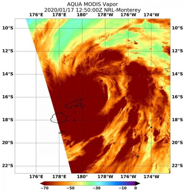
Tropical Cyclone Tino formed near Fiji in the Southern Pacific Ocean and NASA’s Aqua satellite provided meteorologists with a look at the water vapor content of the storm showing potential for heavy rain.
On January 17, 2020, many warnings and watches were in effect from the Fiji Meteorological Service. A tropical cyclone warning is in force for Cikobia, Vanua Levu, Taveuni; and nearby smaller islands, Yasawa, Lau and Lomaiviti Group. A tropical cyclone alert remains in force for the eastern half of Viti levu. A storm warning is in force for Lakeba, Cicia, Tuvuca, Nayau, Oneata, Moce, Komo, Kabara, Namuka-1-Lau, Fulaga and Ogea. A gale warning remain in force for Cikobia, Vanua Levu, Taveuni and nearby smaller islands, eastern half of Viti Levu, Yasawa, the rest of Lau and Lomaiviti group. A strong wind warning remains in force for the rest of the Fiji Group.
Read more at NASA/Goddard Space Flight Center
Image: NASA's Aqua satellite passed over Tropical Cyclone Tino in the Southern Pacific Ocean on Jan. 17 at 7:50 a.m. EST (12:50 UTC) and highest concentrations of water vapor (brown) and coldest cloud top temperatures were around the center of circulation and over Fiji and surrounding islands. (Credit: NASA/NRL)


