
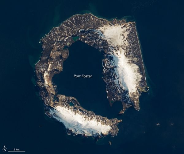
Deception Island is one of the only places in the world where ships can sail directly into the center of an active volcano.
Approximately 4,000 years ago, a volcano in the South Ocean launched massive amounts of rock and magma—between 30 and 60 cubic kilometers—into the sky. The eruption had the same severity as the cataclysmic 1991 eruption of Mount Pinatubo. It was the biggest eruption around Antarctica in the past 12,000 years.
As the volcano’s magma chamber emptied, the sudden drop in pressure inside the volcano caused the top to collapse and form a caldera. The caldera had a diameter of eight to ten kilometers (five to six miles). A collapse at this magnitude is large enough to induce multiple, intense high-magnitude earthquakes, according to researchers.
In the process, the caldera gave the island its unusual horseshoe shape. When explorer Nathaniel Palmer approached the island in 1820, he named it “Deception Island” for its deceptive appearance; it appeared as a normal island from one angle, but a narrow passage actually revealed a harbor (the flooded caldera) that explorers could sail into.
These natural-color images show Deception Island in early autumn and early spring, as observed by the Operational Land Imager on Landsat 8. The left image shows the island on March 23, 2018, when the top of the volcano was visible. The right image, taken on September 21, 2017, shows the volcano and caldera covered in snow and ice.
Continue reading at NASA Earth Observatory
Image via NASA Earth Observatory


