
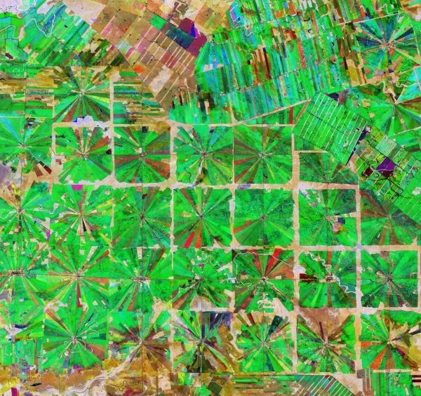
This Copernicus Sentinel-2 image features an area in the Santa Cruz Department of Bolivia, where part of the tropical dry forest has been cleared for agricultural use.
Since the 1980s, the area has been rapidly deforested owing to a large agricultural development effort where people from the Andean high plains (the Altiplano region) have been relocated to the lowlands of Bolivia.
The relatively flat lowlands and abundant rainfall make this region suitable for farming. In fact, the local climate allows farmers to benefit from two growing seasons. The region has been transformed from dense forest into a patterned expanse of agricultural land. This deforestation method, common in this part of Bolivia, is characterised by the radial patterns that can be seen clearly in the image.
Each patterned field is approximately 20 sq km and each side is around 2.5 km long.
Continue reading at European Space Agency
Image via European Space Agency


