
On Sept. 16, 1987, policymakers and scientists from around the world gathered at the International Civil Aviation Organization’s headquarters in Montreal, preparing to take action on the day’s most urgent topic: Depletion of the Earth’s protective ozone layer.
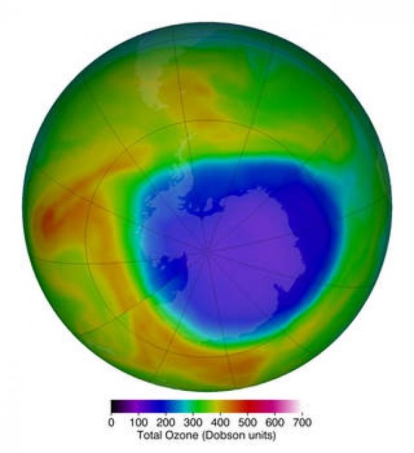
Two years before, researchers from the British Antarctic Survey had stunned the world with the first paper demonstrating that atmospheric ozone levels over Antarctica were dropping at an astonishing rate during the southern hemisphere spring. Shortly after the British paper, NASA showed images from its Total Ozone Mapping Spectrometer (TOMS) that not only confirmed the falling ozone levels, but also showed the extent was broader than anyone realized. The “ozone hole,” as the severely depleted region was dubbed, was the size of the entire Antarctic continent.
Some scientists had warned since the 1970’s that chemicals called chlorofluorocarbons (CFCs) posed a threat to the ozone layer, but no one knew for sure what was causing the ozone hole to develop. The discovery lent urgency to the discussion: How could the world repair the ozone layer before it was too late?
Ozone – a chemical made of three oxygen atoms – is mostly found in a layer about 8-30 miles above Earth’s surface, in the stratosphere. It absorbs harmful ultraviolet (UV) radiation from the Sun, shielding plants, animals and humans from damage ranging from crop death to skin cancer.
Continue reading at NASA Goddard Space Flight Center
Image via NASA Goddard Space Flight Center


