
The study found that Greenland’s ice sheet lost an average of 200 gigatons of ice per year, and Antarctica’s ice sheet lost an average of 118 gigatons of ice per year.
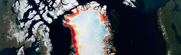
Using the most advanced Earth-observing laser instrument NASA has ever flown in space, scientists have made precise, detailed measurements of how the elevation of the Greenland and Antarctic ice sheets have changed over 16 years.
The results provide insights into how the polar ice sheets are changing, demonstrating definitively that small gains of ice in East Antarctica are dwarfed by massive losses in West Antarctica. The scientists found the net loss of ice from Antarctica, along with Greenland’s shrinking ice sheet, has been responsible for 0.55 inches (14 millimeters) of sea level rise between 2003 and 2019 – slightly less than a third of the total amount of sea level rise observed in the world’s oceans.
The findings come from NASA’s Ice, Cloud and land Elevation Satellite 2 (ICESat-2), which launched in 2018 to make detailed global elevation measurements, including over Earth’s frozen regions. By comparing the recent data with measurements taken by the original ICESat from 2003 to 2009, researchers have generated a comprehensive portrait of the complexities of ice sheet change and insights about the future of Greenland and Antarctica.
Continue reading at NASA Goddard Space Flight Center
Image via NASA Goddard Space Flight Center


