
Using the most advanced Earth-observing laser instrument NASA has ever flown in space, a team of scientists led by the University of Washington has made precise measurements of how the Greenland and Antarctic ice sheets have changed over 16 years.
Using the most advanced Earth-observing laser instrument NASA has ever flown in space, a team of scientists led by the University of Washington has made precise measurements of how the Greenland and Antarctic ice sheets have changed over 16 years.
In a new study published April 30 in the journal Science, researchers found the net loss of ice from Antarctica, along with Greenland’s shrinking ice sheet, has been responsible for 0.55 inches (14 millimeters) of sea level rise to the global ocean since 2003. In Antarctica, sea level rise is being driven by the loss of the floating ice shelves melting in a warming ocean. These ice shelves help hold back the flow of land-based ice.
The findings come from the Ice, Cloud and land Elevation Satellite 2 (ICESat-2), which was launched into orbit in fall 2018 and began taking detailed global elevation measurements, including over Earth’s frozen regions. By comparing the new data with measurements taken by the original ICESat from 2003 to 2009, researchers have generated a comprehensive portrait of the complexities of ice sheet change — and insights into the future of Greenland and Antarctica.
Read more at University Of Washington
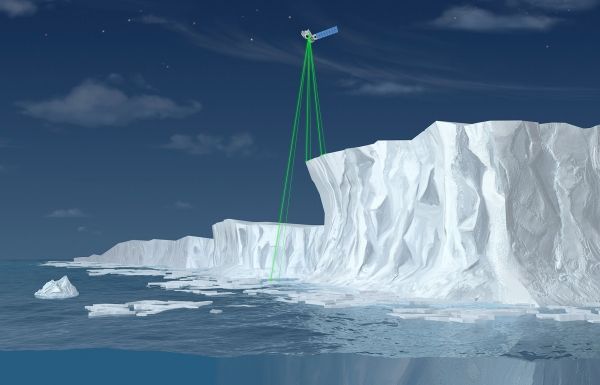
Image: ICESat-2 uses its six laser beams (green) to measure elevations over an ice sheet, as illustrated in this artist’s rendering. By comparing height measurements from ICESat-2 with similar measurements from the original ICESat, which operated from 2003 to 2009, scientists can determine how much ice has been lost. CREDIT: NASA, ICESat-2/SCAD Collaborative Student Project


