
NASA’s Aqua satellite obtained visible imagery as Tropical Storm Hanna formed in the Gulf of Mexico and continued to organize.
A new animation from NASA shows how Hanna developed and intensified as it heads toward landfall in Texas this weekend.
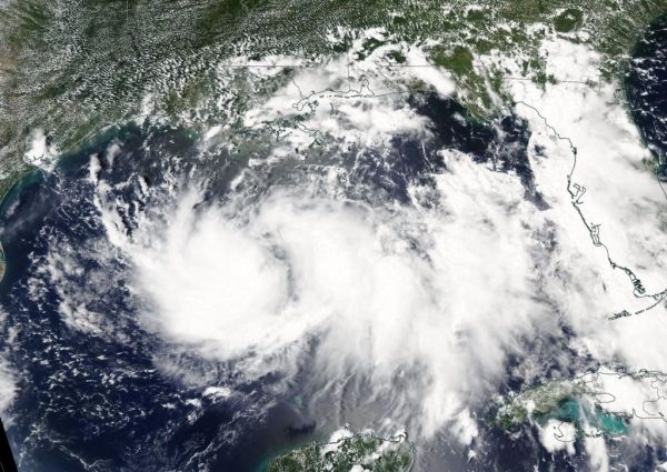
The Moderate Imaging Spectroradiometer or MODIS instrument that flies aboard NASA’s Aqua satellite captured a visible image of Tropical Storm Hanna on July 23 at 1:30 p.m. EDT. The image showed the storm appeared more organized and had a more rounded shape than it did the previous couple of days. That is an indication that the storm was consolidating, organizing and strengthening.
Satellite imagery from the two days before were coupled with the July 23 image and made into an animation using NASA’s Worldview product at NASA’s Goddard Space Flight Center in Greenbelt, Md. That animation showed the clouds associated with the low-pressure area near south Florida and moving west over the Gulf of Mexico where it formed into a depression and further into a tropical storm.
Continue reading at NASA Goddard Space Flight Center
Image via NASA Goddard Space Flight Center


