
Imagery from NASA’s Terra satellite was used to create an animation showing Douglas’ movement past the Hawaiian Islands.
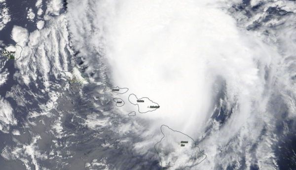
Although the Hawaiian Islands missed a landfall from Hurricane Douglas, the storm was certainly close enough to bring strong surf, heavy rains and gusty winds to the islands. NASA’s Terra satellite imagery showed the storm’s track as it moved just north of the islands.
Visible imagery of Hurricane Douglas from July 25 to 26, taken from the Moderate Resolution Imaging Spectroradiometer or MODIS instrument aboard NASA’s Terra satellite was compiled and made into an animation using NASA’s Worldview application. The imagery showed Douglas’ center staying just off shore from the Hawaiian Islands.
NASA’s Earth Observing System Data and Information System (EOSDIS) Worldview application provides the capability to interactively browse over 700 global, full-resolution satellite imagery layers and then download the underlying data. Many of the available imagery layers are updated within three hours of observation, essentially showing the entire Earth as it looks “right now.”
Continue reading at NASA Goddard Space Flight Center
Image via NASA Goddard Space Flight Center


