
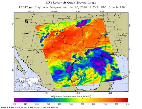
NASA’s Aqua satellite provided infrared data on Tropical Depression Hanna while imagery from NASA-NOAA’s Suomi NPP satellite was used to create an animation showing its movement from Texas to Mexico.
Infrared data can reveal the location of powerful storms that generate heavy rainfall and Hanna drenched Texas upon landfall over the weekend of July 25-26.
Visible imagery of Hurricane Hanna from July 23 to 26, taken from the Visible Infrared Imaging Radiometer Suite (VIIRS) instrument aboard NASA-NOAA’s Suomi NPP satellite was compiled and made into an animation using NASA’s Worldview application. The imagery showed Hanna’s landfall in east central Texas and its track to the southwest into north central Mexico.
Continue reading at NASA Goddard Space Flight Center
Image via NASA Goddard Space Flight Center


