
A drought around South America’s second longest river has grounded ships and contributed to a rash of fire in the delta and floodplain.
A prolonged period of unusually warm weather and drought in southern Brazil, Paraguay, and northern Argentina has dropped the Paraná River to its lowest water levels in decades. The parched river basin has hampered shipping and contributed to an increase in fire activity in the delta and floodplain.
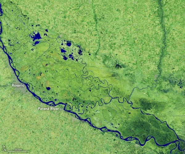
On July 3, 2020, the Operational Land Imager (OLI) on Landsat 8 captured this false-color image (bands 7-6-4) of the river near Rosario, a key port city in Argentina. The combination of shortwave infrared and visible light makes it easier to distinguish between land and water. Water appears dark blue or black. The second image shows the same area on July 1, 2019, a day when water levels were high across many of the delta’s marshes, lagoons, islands, and meandering streams.
Data from the Argentine coast guard shows that, on July 3, 2020, river gauges near Rosario stood at 1 meter (39 inches)—higher than in May 2020, when it dipped as low as 0.08 meters (3 inches).
Continue reading at NASA Earth Observatory
Image via NASA Earth Observatory


