
A Tropical Storm Watch is in effect for the central Bahamas, including Cat Island, the Exumas, Long Island, Rum Cay, and San Salvador.
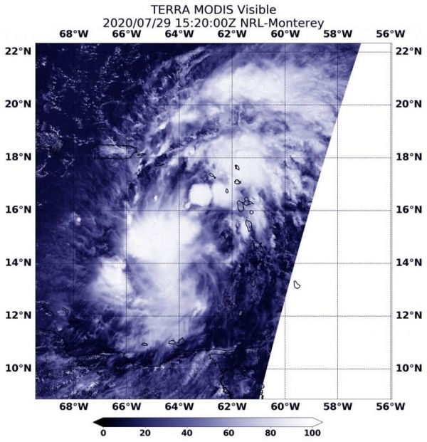
NASA’s Terra satellite obtained visible imagery of Potential Tropical Cyclone 9 after it moved into the Eastern Caribbean Sea and continued bringing heavy rainfall and gusty winds to the Leeward Islands, the U.S. and British Virgin Islands and Puerto Rico.
The National Hurricane Center has issued a number of warnings and watches associated with this potential tropical cyclone. A Tropical Storm Warning is in effect for Puerto Rico, Vieques, Culebra, the U.S. Virgin Islands, the British Virgin Islands, Montserrat, St. Kitts, Nevis, and Anguilla, St. Martin, and St. Barthelemy, Saba and St. Eustatius, St. Maarten, the Dominican Republic’s entire southern and northern coastlines, the north coast of Haiti from Le Mole St Nicholas eastward to the northern border with the Dominican Republic, the Turks and Caicos Islands and the southeastern Bahamas including the Acklins, Crooked Island, Long Cay, the Inaguas, Mayaguana, and the Ragged Islands.
Continue reading at NASA Goddard Space Flight Center
Image via NASA Goddard Space Flight Center


