
The strong wind shear that weakened Douglas to a tropical storm early on July 29 has further weakened it to a post-tropical low-pressure area.
NASA’s Aqua satellite provided an infrared view of those remnants, headed across the International Date Line in the Pacific Ocean.
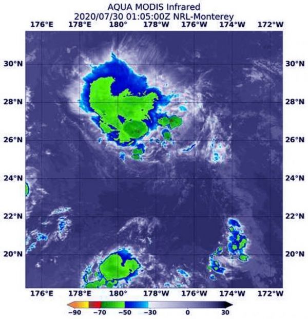
NASA’s Aqua satellite uses infrared light to analyze the strength of storms by providing temperature information about the system’s clouds. The strongest thunderstorms that reach high into the atmosphere have the coldest cloud top temperatures.
On July 30 at 0105 UTC (July 29 at 9:05 p.m. EDT), the Moderate Resolution Imaging Spectroradiometer or MODIS instrument that flies aboard NASA’s Aqua satellite gathered infrared data on Douglas that confirmed wind shear had reduced the storm to a post-tropical low pressure area. The wind shear pushed the coldest cloud tops northeast of the center. Those storms had cloud top temperatures as cold as minus 50 degrees Fahrenheit (minus 45.5 Celsius).
Continue reading at NASA Goddard Space Flight Center
Image via NASA Goddard Space Flight Center


