
The National Hurricane Center (NHC) posted many watches and warnings as Isaias moved through the Caribbean Sea on July 30.
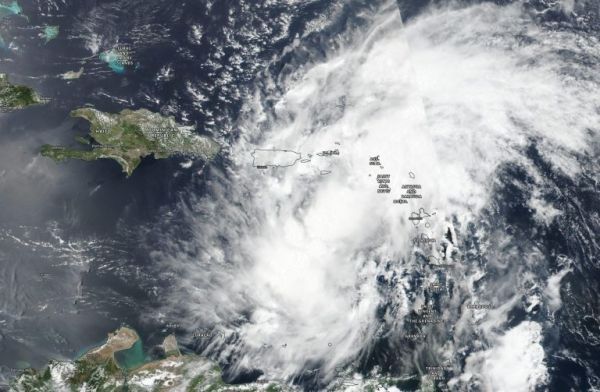
NASA-NOAA’s Suomi NPP satellite provided visible imagery of the development and movement of Tropical Storm Isaias is it moved into the eastern Caribbean Sea. NASA’s Aqua satellite provided temperature information that gave insight into Isaias’ rainmaking potential.
The Visible Infrared Imaging Radiometer Suite (VIIRS) instrument aboard Suomi NPP provided a visible image of Potential Tropical Cyclone 9 on July 28. The storm developed into Tropical Storm Isaias on July 29. The imagery showed the broader circulation of the disturbance had become slightly better defined but at the time of the July 29 image, Air Force Reserve reconnaissance aircraft was still unable to find a well-defined circulation.
Later in the day, by 5 p.m. EDT, deep convection continued to increase and a band of thunderstorms developed over the southwestern portion of the broad circulation. By 11 p.m., the storm had developed into a tropical storm. The National Hurricane center noted, “Observations from recent scatterometer passes over the system show that it now has a sufficiently well-defined center to be designated as a tropical cyclone.”
Continue reading at NASA Goddard Space Flight Center
Image via NASA Goddard Space Flight Center


