
Tropical Storm Isaias made landfall late on Aug. 3 and by today, Aug. 4, the huge storm stretched from Virginia to Maine.
Tropical Storm Isaias made landfall late on Aug. 3 and by today, Aug. 4, the huge storm stretched from Virginia to Maine. NASA satellites have been providing forecasters with rainfall rates, cloud top temperatures, storm extent and strength as Isaias batters the U.S. East Coast.
NOAA’s National Hurricane Center (NHC) posted many warnings and watches on Aug. 4. Storm Surge Warning is in effect for the Pamlico and Albemarle Sounds, Ocracoke Inlet, North Carolina to the North Carolina/Virginia border.
A Tropical Storm Warning is in effect from north of Surf City, North Carolina to Eastport, Maine, for the Pamlico and Albemarle Sounds, the Chesapeake Bay, the Tidal Potomac River, Delaware Bay, Long Island and Long Island Sound, NY, Martha’s Vineyard, Nantucket, and Block Island.
Read more at: NASA/Goddard Space Flight Center
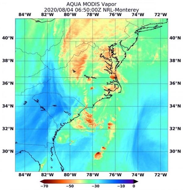
NASA's Aqua satellite passed over Isaias on Aug. 4 at 2:50 a.m. EDT (0650 UTC). Coldest cloud top temperatures (darker brown) were as cold as or colder than minus 70 degrees Fahrenheit (minus 56.6 degrees Celsius) in some of the bands of thunderstorms north of Isaias's center. These temps were also found over parts of Virginia, Pennsylvania, Maryland, Delaware, and over the Atlantic Ocean. Storms with cloud top temperatures that cold have the capability to produce heavy rainfall. (Photo Credit: NASA/NRL)


