
Researchers have modeled how coastal flooding will impact commutes in the Bay Area over the next 20 years. Regions with sparse road networks will have some of the worst commute delays, regardless of their distances from the coast.
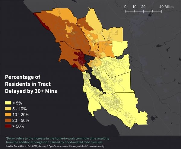
For decades, the low-lying neighborhoods along the San Francisco Bay have experienced coastal flooding and the subsequent traffic disruptions. But a new computational model by Stanford researchers reveals that, due to the nature of road networks in the region, commuters living outside the areas of flooding may experience some of the largest commute delays.
By integrating traffic models with regional flood maps, researchers have demonstrated how San Francisco Bay Area commute disruptions spread substantially inland, creating longer delays for communities with sparse road networks than for those in the areas of flooding. Climate change is exacerbating the situation by increasing the likelihood of extreme events like flooding. The research, published Aug. 5 in Science Advances, reveals that measuring road network density may be more important for understanding community resilience to flood-related commute delays than actual flood exposure.
Continue reading at Stanford University
Image via Stanford University


