
NASA-NOAA’s Suomi NPP satellite provided a night-time image of Elida in the Eastern Pacific Ocean that helped confirm the storm had weakened to a post-tropical cyclone.
The National Hurricane Center (NHC) defines a post-tropical cyclone as a former tropical cyclone. This generic term describes a cyclone that no longer possesses sufficient tropical characteristics to be considered a tropical cyclone. Post-tropical cyclones can continue carrying heavy rains and high winds. Note that former tropical cyclones that have become fully extratropical… as well as remnant low pressure areas… are two classes of post-tropical cyclones.
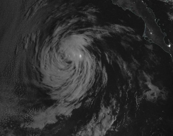
The Visible Infrared Imaging Radiometer Suite (VIIRS) instrument aboard Suomi NPP provided a night-time image of Elida on Aug. 12 at 10 p.m. PDT (Aug. 13 at 0500 UTC). The imagery showed that Elida was still devoid of strong thunderstorms. The image was created using the NASA Worldview application.
Continue reading at NASA Goddard Space Flight Center
Image via NASA Goddard Space Flight Center


