
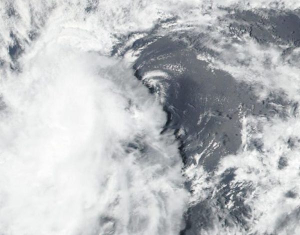
NASA-NOAA’s Suomi NPP satellite provided forecasters with a visible image of a struggling Tropical Depression 10E in the Eastern Pacific Ocean.
Wind shear is preventing the storm from intensifying into a tropical storm.
On Aug. 13, the Visible Infrared Imaging Radiometer Suite (VIIRS) instrument aboard Suomi NPP revealed northeasterly wind shear had exposed the center of circulation and pushed the bulk of clouds and precipitation to the southwest of the center. The depression has maintained a small ragged band of convection in its southwest quadrant.
Vertical wind shear, that is, winds outside of a tropical cyclone at different heights in the atmosphere (the troposphere), pushes against a tropical cyclone and tears it apart.
Continue reading at NASA Goddard Space Flight Center
Image via NASA Goddard Space Flight Center


