
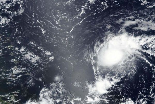
NASA-NOAA’s Suomi NPP satellite provided forecasters with a visible image of Tropical Storm Josephine east of the Lesser Antilles island chain.
Suomi NPP revealed that Josephine was being affected by wind shear.
The Lesser Antilles is a group of islands that form the boundary of the western Atlantic Ocean and the Caribbean Sea (to the west). They are a long, partly volcanic island arc stretching between the Greater Antilles to the north-west and South America.
On Aug. 13, the Visible Infrared Imaging Radiometer Suite (VIIRS) instrument aboard Suomi NPP revealed southwesterly wind shear was pushing the bulk of clouds and precipitation to the northeast of the center, giving the storm an elongated appearance.
Continue reading at NASA Goddard Space Flight Center
Image via NASA Goddard Space Flight Center


