
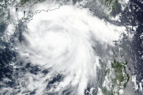
NASA-NOAA’s Suomi NPP satellite passed over the South China Sea and captured a visible image of Tropical Storm Higos. Higos is headed for landfall in southeastern China.
The Visible Infrared Imaging Radiometer Suite (VIIRS) instrument aboard Suomi NPP provided a visible image of Tropical Storm Higos is it moved in a northwesterly direction and toward a landfall in southeastern China. The VIIRS image revealed deep, persistent convection and developing thunderstorms obscuring a low-level circulation center. The VIIRS image also showed there were bands of thunderstorms wrapping around the northern periphery of the system.
At 11 a.m. EDT (1500 UTC), Tropical Storm Higos had maximum sustained winds near 45 knots (52 mph/83 kph). It was located near latitude 21.3 degrees north and longitude 114.3 degrees east, about 82 nautical miles south-southeast of Hong Kong, China.
Continue reading at NASA Goddard Space Flight Center
Image via NASA Goddard Space Flight Center


