
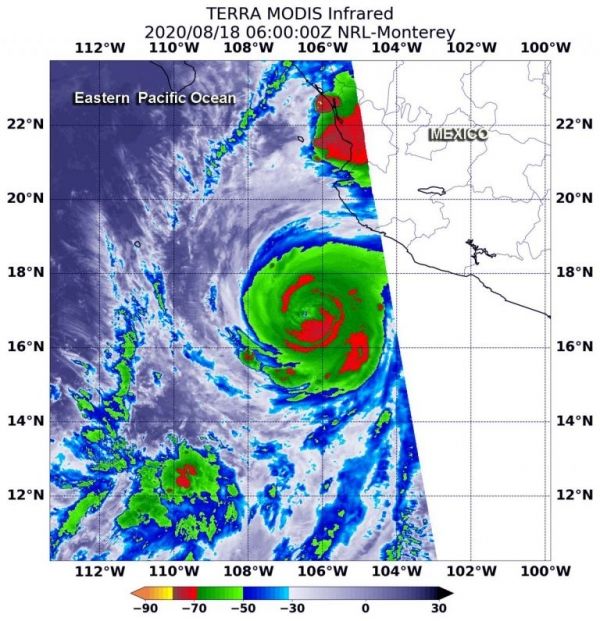
Very powerful storms with heavy rainmaking capability reach high into the atmosphere and those have very cold cloud top temperatures.
Infrared imagery from NASA’s Terra satellite measured those temperatures and found powerful storms in the rapidly intensifying, major Hurricane Genevieve.
On Aug. 18, NOAA’s National Hurricane Center (NHC) noted that Genevieve had intensified into a Category 4 hurricane on the Saffir-Simpson Hurricane Scale. That makes Genevieve a major hurricane, and it is affecting the west coast of Mexico.
Continue reading at NASA Goddard Space Flight Center
Image via NASA Goddard Space Flight Center


