
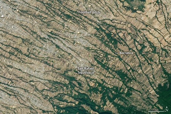
The network of narrow stream valleys that flow off this towering volcano in central Mexico are sometimes used as roads—or convenient places to set up soccer pitches or sift for building materials.
With an elevation of 4462 meters (14,639 feet), La Malinche volcano in central Mexico soars above the patchwork of cities, farms, and forests in the surrounding lowlands. Montane grasslands and shrubs dominate at the highest elevations, the heart of La Malinche National Park and the coolest part of the eroded, dormant volcano. At lower elevations, a ring of pine, oak, and alder forests covers the mountain’s middle slopes before transitioning into a tapestry of farmland, villages, and narrow stream valleys called barrancas.
On January 9, 2020, the Operational Land Imager (OLI) on Landsat 8 acquired a natural-color image of part of the northwestern side of the mountain, near the village of San Rafael Tepatlaxco. Several barrancas, many of them flanked by trees, cut across the sloped landscape. The image below offers a broader view of the whole mountain.
Continue reading at NASA Earth Observatory
Image via NASA Earth Observatory


