
When a hail storm strikes, the damage can be catastrophic for homes, businesses, agriculture and infrastructure.
In fact, with damage totals sometimes exceeding $1 billion, hailstorms are the costliest severe storm hazard for the insurance industry, making reliable, long-term data necessary to estimate insured damage and assess extreme loss risks.
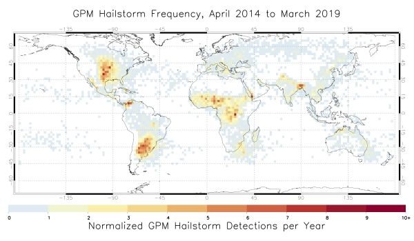
That’s why a team of NASA scientists is working with international partners to use satellite data to detect hailstorms, hail damage, and improve our understanding of hail frequency. This project will provide long term regional- to global-scale maps of severe storm occurrence, catastrophe models, and new methods to improve short-term forecasting of these storms.
“We’re using data from many satellite sensors to really dig in and understand when and where hailstorms are likely to occur and the widespread damage that they can cause," said Kristopher Bedka, principal investigator at NASA's Langley Research Center in Hampton, Virginia. "This is a first-of-its-kind project and we’re beginning to show how useful this satellite data can be to the reinsurance industry, forecasters, researchers, and many other stakeholders.”
Continue reading at NASA Langley Research Center
Image via NASA Langley Research Center


