
Tropical Storm Sally was deemed a hurricane on Sept. 14 just after NASA’s Aqua satellite provided data on the storm.
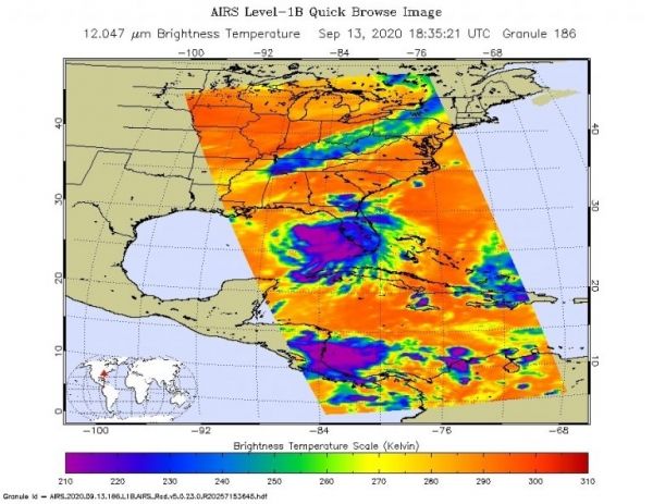
On Sunday, Sept. 13, NASA analyzed Sally’s cloud top temperatures to gauge if the storm was strengthening. Cloud top temperatures provide information to forecasters about where the strongest storms are located within a tropical cyclone. The stronger the storms, the higher they extend into the troposphere, and the colder the cloud temperatures.
On Sept. 13 at 2:35 p.m. EDT (1835 UTC) NASA’s Aqua satellite analyzed Tropical Storm Sally using the Atmospheric Infrared Sounder or AIRS instrument. AIRS found coldest cloud top temperatures as cold as or colder than minus 63 degrees Fahrenheit (minus 53 degrees Celsius) around the center and east of the center. NASA research has shown that cloud top temperatures that cold indicate strong storms that have the capability to create heavy rain.
Continue reading at NASA Goddard Space Flight Center
Image via NASA Goddard Space Flight Center


