
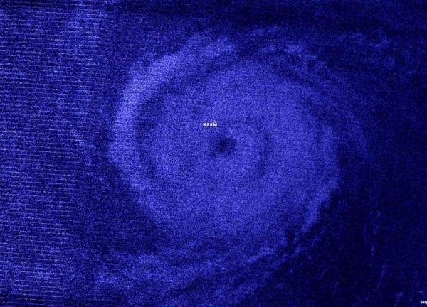
Night-time imagery from NASA-NOAA’s Suomi NPP satellite showed Hurricane Paulette’s large eye approaching the island of Bermuda. A Hurricane Warning is in effect for Bermuda.
Bermuda is a British territory in the western Atlantic Ocean. It is located approximately 643 miles (1,035 km) east-southeast of Cape Hatteras, North Carolina.
The Visible Infrared Imaging Radiometer Suite (VIIRS) instrument aboard Suomi NPP provided a nighttime image of Hurricane Paulette at 1:30 a.m. EDT (0530 UTC). The large eye, between 35 and 40 miles in diameter, was clearly apparent in the nighttime image, and it was surrounded by powerful thunderstorms. Hurricane-force winds extend outward up to 45 miles (75 km) from the center and tropical-storm-force winds extend outward up to 175 miles (280 km).
The image was created using the NASA Worldview application at NASA’s Goddard Space Flight Center in Greenbelt, Md.
Continue reading at NASA Goddard Space Flight Center
Image via NASA Goddard Space Flight Center


